GeoMap NZ logo
Home About Services Technology Gallery Contact
GeoMap NZ logo
Home About Services Technology Gallery Contact
Real mapping examples

Gallery

The best way to understand drone mapping is to actually look at it. This gallery shows examples of our orthomosaics, aerial imagery, 3D models, and mapping outputs. Click the examples to open higher-resolution versions where available.

Full overview of a 100-acre farm orthomosaic

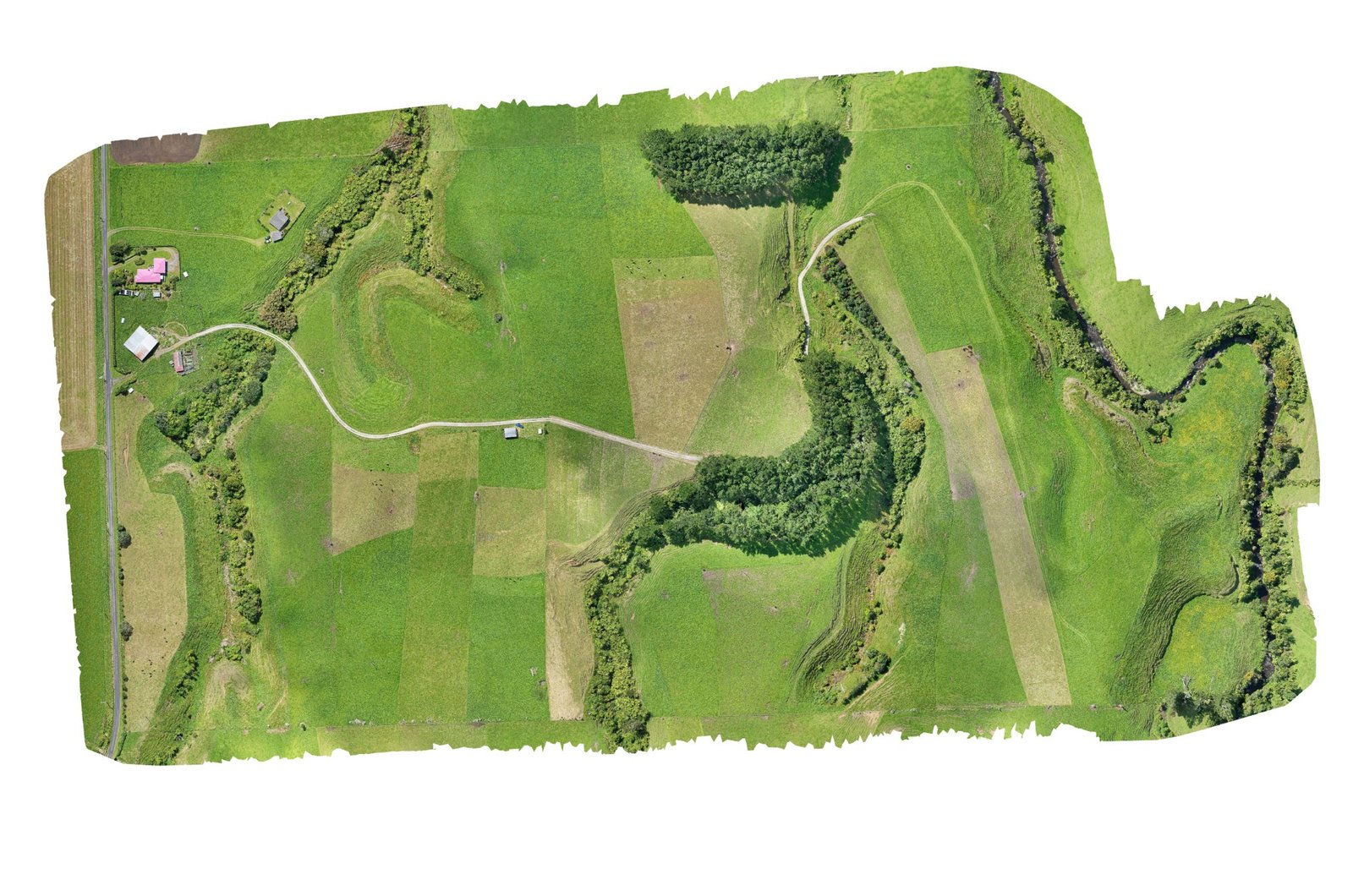
100 Acre Farm Orthomosaic

A full-site orthomosaic overview made from 912 overlapping drone photos. This header example shows the whole property in one stitched aerial map, while the full-resolution file can be downloaded separately for proper zooming and inspection.

  • Site size: 100 acres
  • Ground sampling distance: 3 cm
  • Flight height: 80 m
  • Photos used: 912
  • Output: Full orthomosaic overview
Download full-resolution orthomosaic

Full-resolution PNG is a large file, around 500 MB, and may take a while to download. Upload the full file to the downloads folder using this exact file name.

Cropped section from the same high-resolution farm orthomosaic

Cropped Section From the Same Orthomosaic

A zoomed-in crop from the same 100-acre farm orthomosaic, showing the level of detail captured in the final stitched map. This type of view is useful for checking tracks, vegetation, planting areas, waterways, fence lines, access routes and general site features.

  • Site size: 100 acres
  • Ground sampling distance: 3 cm
  • Flight height: 80 m
  • Photos used: 912
  • Output: High-resolution orthomosaic crop
Download full-resolution image
Textured 3D model example

Private Site — Textured 3D Model

A textured 3D model created from drone imagery. These models help show the shape of the land, buildings, access, vegetation and the general feel of a site in a way that is much easier to understand than flat images alone.

  • Site: Private property example
  • Output: Textured 3D model
  • Use: Site visualisation, measurements, planning and design reference
Watch 3D model fly-through

Replace this button link with the YouTube fly-through once the video is ready.

RTK mapping equipment in the field

RTK / GNSS Equipment in the Field

Field equipment and ground control help support practical capture, repeat monitoring, georeferencing and stronger site confidence where the project needs it.

  • Output: RTK and GNSS-supported mapping
  • Use: Ground control, repeatable surveys and mapping confidence
Get in touch
Sam Kirk — 022 492 4583 Malachi Kirk — 020 489 8657 geomapnz@gmail.com
Based in Okato, Taranaki, available across NZ.
Download our capability statement