High resolution drone mapping
Drone mapping you can actually use
At GeoMap NZ, we make maps you can properly use. We create very high-resolution aerial maps that are correctly georeferenced and useful for real site work, planning, measuring, and understanding land.
We can also link GIS data and useful map layers to the imagery, so the final output is clearer, more practical, and better suited to what you actually need. Alongside flat aerial maps, we can build 3D models that let you look around a site, take measurements, and get a much better feel for the land or project.
Based in Okato, Taranaki, available across NZ.
Website still in development
This website is still being developed and improved over time. We are continuing to add better examples, clearer service information, and more details about our mapping, 3D modelling, multispectral and GIS workflows.
About GeoMap NZ
GeoMap NZ started with an old Phantom 3 that we barely used for years. One day, Sam came up with the idea of getting into drone mapping, and from there things started to grow. As we learned more, practiced more, and built up our skills and equipment, it turned into something bigger and became GeoMap NZ. We’ve come a long way already, and we’re still learning, improving, and building on it all the time.
Father and son
Built by Sam Kirk and Malachi Kirk as a local Taranaki business with room to keep growing.
Useful outputs
Orthomosaics, 3D models, GIS layers, multispectral mapping and practical measurements.
Technology preview
Professional gear and positioning workflows that support accurate, practical mapping outputs.
Drones
Phantom 4 RTK drones with 20-megapixel mechanical shutter cameras, plus Phantom 4 Multispectral for vegetation and land monitoring work.
View technologyGNSS
GNSS base and rover setup for ground control points and stronger positional confidence where needed.
View technologyRepeat surveys
Saved flight paths make it easier to come back later and monitor change across months or years.
View servicesExample outputs
A few example visuals showing the difference between a whole-site orthomosaic and a closer detail view.
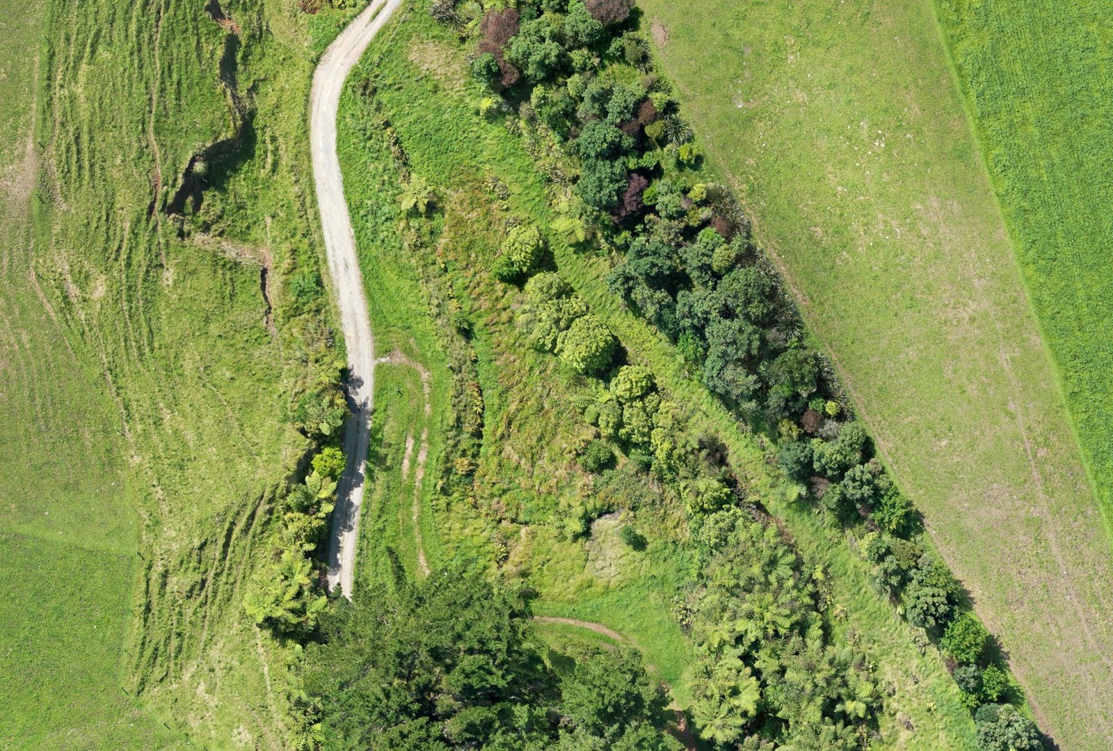
Close-up orthomosaic detail showing tracks, vegetation, waterways, access and site features.
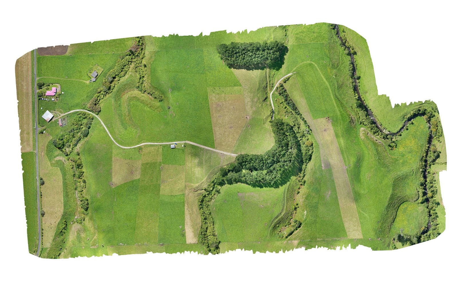
100 acre farm orthomosaic overview captured from 912 photos at 80 m flight height.
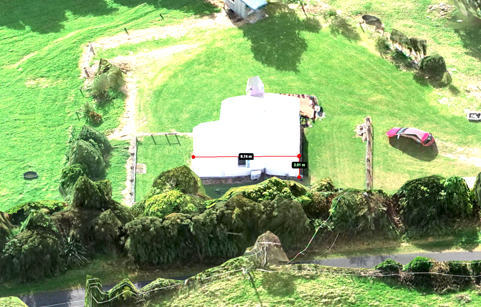
3D model outputs can help show shape, access, vegetation, buildings and the feel of a site.
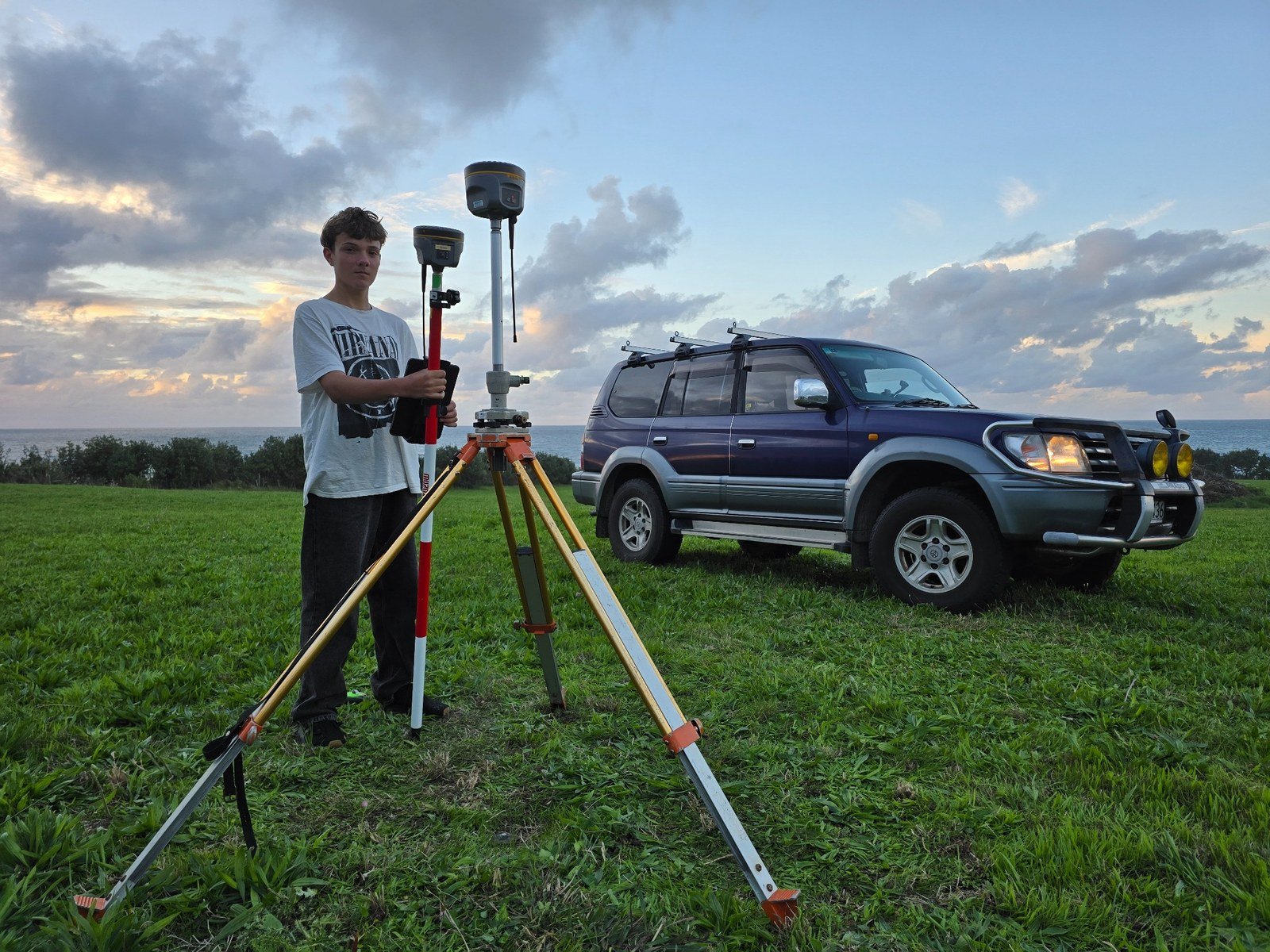
Field setup and ground control support practical capture, repeat monitoring and stronger site confidence.
Want to talk through a site?
There is only so much you can understand from a website. Get in touch and we can talk through what kind of mapping might actually suit your project.