
AI Native Tree ID Model
Building a ground-truthed way to identify native trees across a block of land.
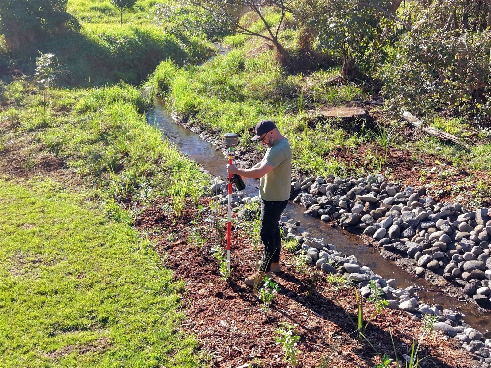
Geomap is currently building a native tree identification model. It's built on a huge amount of walking through bush, repairing and planting, tagging each tree with a GNSS rover to within 2–5 cm, and building a ground-truth library.
Every drone flight over the area is verified by humans against that library. It's a work in progress towards a machine learning model for automatic identification of trees across a block of land, to assist with vegetation and land classification.
Get in touch to learn more.
Ground-truthing as a service
Accurate positions and species labels, ready for your own project.
Accurate ground-truthing, project-ready
The same accurate ground-truthing method is available to help others build their own models — accurate tree positions and species labels, ready for your own project.
That's Sam in the photo — geotagging a freshly planted native with the RTK rover.
Case study: a stream planting in Taranaki
One stream, 750 plants, and the first 289 tagged on planting day.
A coastal Taranaki stream, recently brought back into the open from a culvert, was planted out in autumn 2026 by local schools, contractors and the community — 750 plants.
The survey started on planting day, with 289 plants tagged with the GNSS rover before time ran out. The rest will be tagged on the next flight day on site. Repeat flights build an already-ground-truthed dataset. It is the first of what we hope will be many sites supporting the land classification research. Geomap NZ is really pleased to be involved.
The long-term aim is to help environmental groups make informed decisions about which endemic natives do well where, and make planting programmes more successful — through data, efficiently, across seasons.
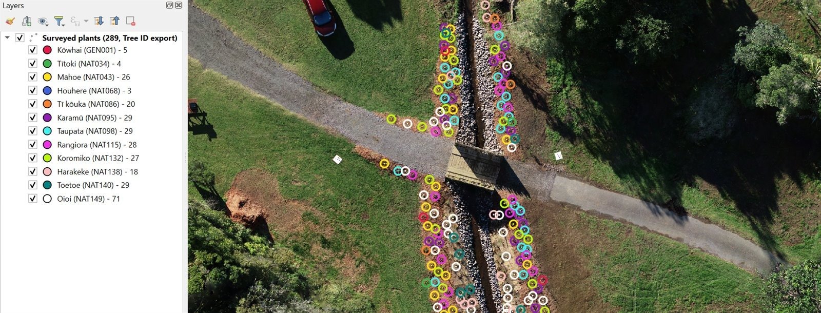
289 plants across 13 native species, colour-coded by species, over the 6.8 mm orthomosaic.
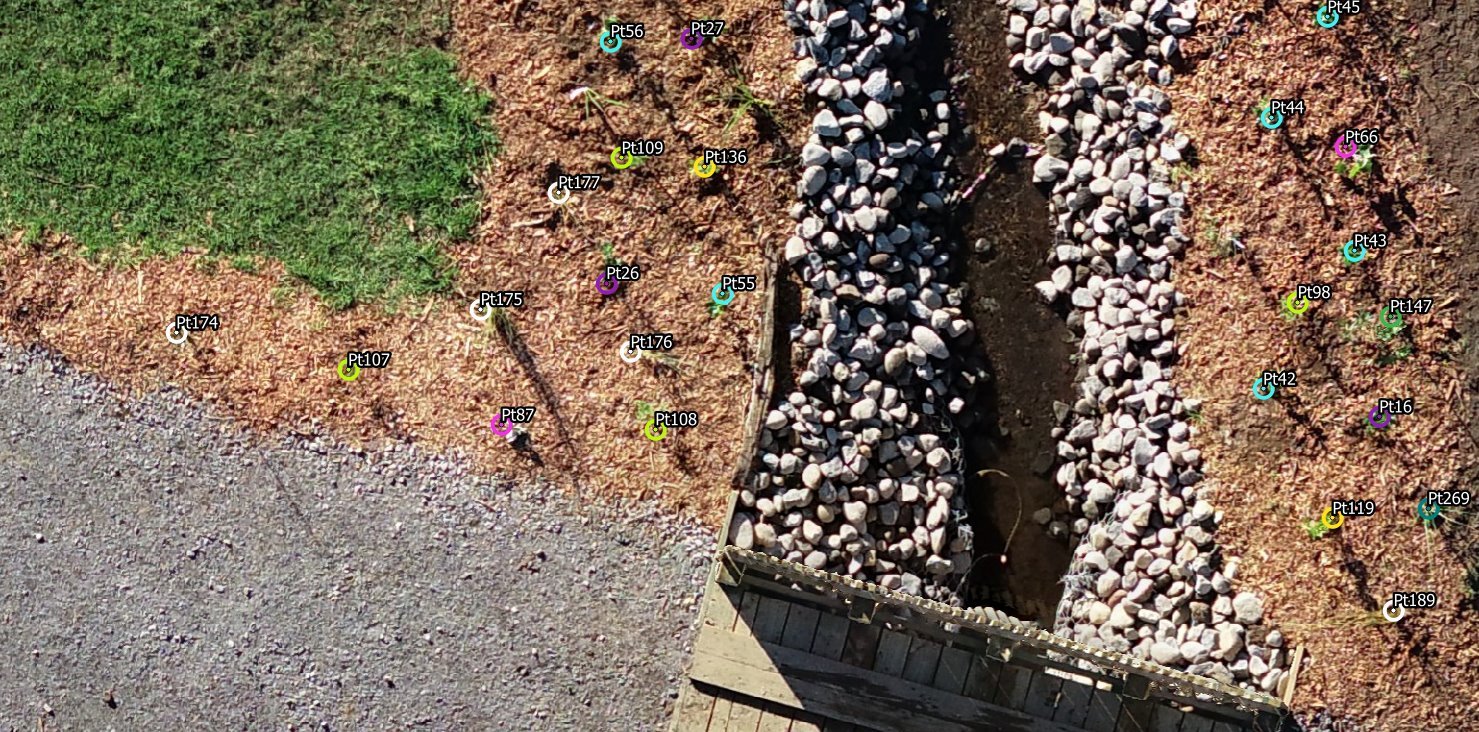
Each plant on its own point, accurate to the plant, not the patch.
Want to know more?
Sam can walk you through the work underway and how it might apply to your block.