Orthomosaics
Hundreds or thousands of individual photos, stitched and merged by software into one coherent, georeferenced, scaled big picture. It’s our main product and the one we’ve honed the most — any size area, any flight height.
Ground sampling distance is the size of one pixel on the ground.
A typical satellite or Google Earth view is around 20 cm ground sampling distance or coarser. Our standard drone flights go down to 6.7 mm, and lower for special applications such as research and high-detail gardens. Typical jobs: a dairy farm at 2–3 cm, a lifestyle block around 1 cm, depending on the use.
Drone orthomosaic vs Google Earth
Two views of the same Taranaki ground, about 20 m across.
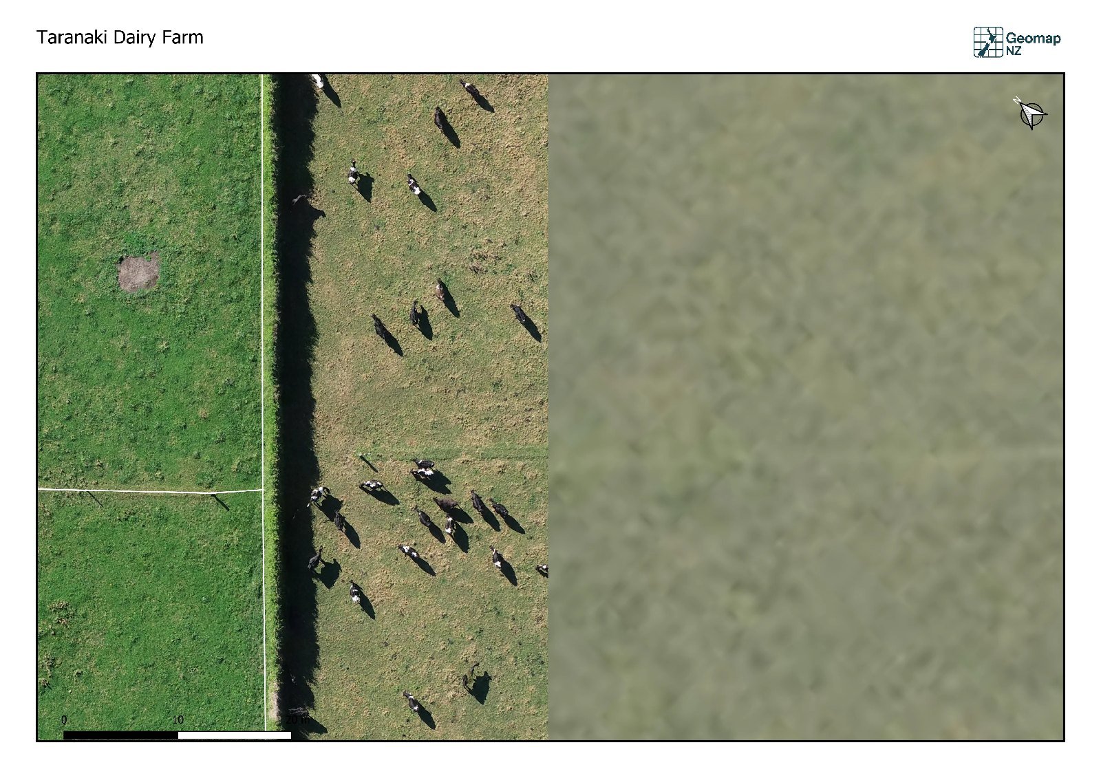
On the left is our 3 cm drone orthomosaic — you can count the cows and see every fence post. On the right, the best public satellite imagery of the same ground is a green blur. That difference is why we fly rather than rely on what's already online.
Example orthomosaics
More on the way.
We have flown and processed a range of orthomosaics, and we are waiting on approval from the people whose land they show before we publish them here.
In the meantime, the Resolution (GSD) page shows one block flown at four heights, and we are happy to show you more in person. Get in touch.
As-built surveys
With the RTK rover we pick up underground services, pipes, drains, structures and other features on site and overlay them on the ortho, for records, planning and handover.
This is not cadastral surveying. Geomap NZ does not do boundary or cadastral work — that's a licensed cadastral surveyor's job.
Need an orthomosaic for your site?
Tell us about your land and what you need it for.