One block, four flight heights
GSD, ground sampling distance, is the size of one pixel on the ground. Fly lower and each pixel covers less ground, so you see more. We flew one Taranaki lifestyle block at four heights to show what that buys you, and compared it with the free national aerial photo.
Map system · NZGD2000 / NZTM2000, heights NZVD2016
Why flight height matters
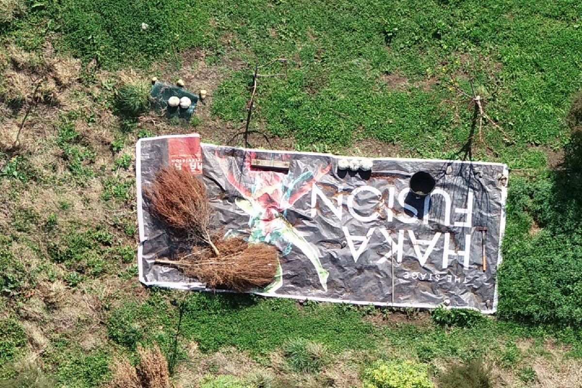
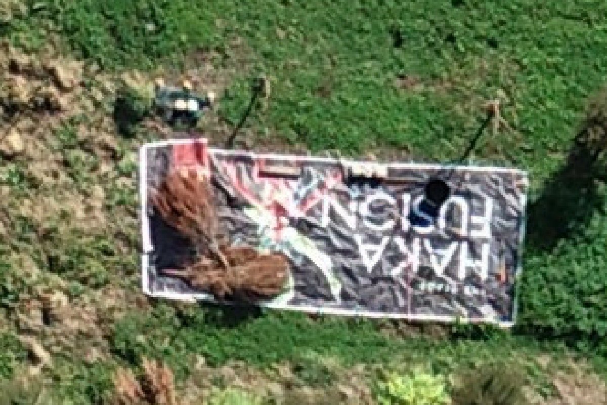
The same 12 × 8 m patch from each flight: the banner lying in the paddock by the middle shed. Every pixel is shown as it is, not smoothed. Drag the divider to compare.
Drone vs the free national photo
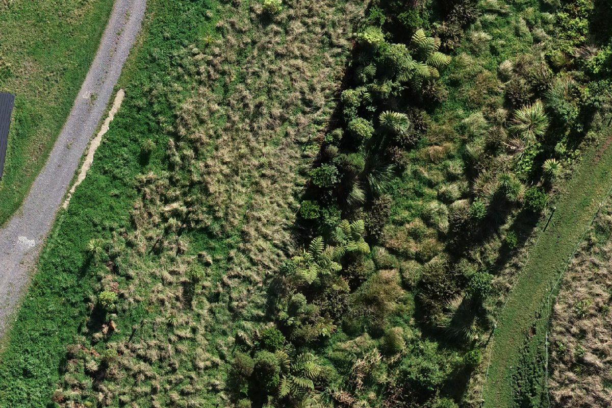
A 48 × 32 m stretch of the gully. Left, our 60 m flight. Right, the most recent free aerial photo of the same spot, flown by LINZ (Land Information New Zealand) in November 2021 at 25 cm per pixel. In 2021 this was rough paddock; the tree ferns, flax and natives are Anna's planting since.
What about Google Earth? Google does not publish the pixel size of its imagery. In rural New Zealand it is usually aerial or satellite photography of about 25 to 50 cm per pixel, often the same national photography shown here, and often a few years old. So the right-hand side is close to what Google Earth shows of this place: about 14 times coarser than this 60 m flight in each direction (32 times coarser than the 25 m flight), and from before the house was built.
Why LINZ and not a Google Earth screenshot? Google's terms do not allow its imagery to be copied into other pages. LINZ publishes its aerial photography under a Creative Commons Attribution 4.0 licence, which allows it to be shown with credit: aerial imagery sourced from LINZ, CC BY 4.0.
This is not cadastral surveying. Geomap NZ does not do boundary or cadastral work — that's a licensed cadastral surveyor's job.
What each height gives you
| Flight height | Pixel size | Ortho file (4 ha) | On the banner you can read |
|---|---|---|---|
| 120 m | 3.69 cm | 56 MB | The big lettering, softly; the small print is gone |
| 100 m | 2.90 cm | 173 MB | The big lettering clearly; the small print is a blur |
| 60 m | 1.77 cm | 494 MB | The small print, just; tent pegs and guy ropes |
| 25 m drone | 0.77 cm | 2.60 GB | The small print sharply; the tools left on the banner |
| LINZ national aerial, 2021 | 25 cm | free | Nothing: the banner, the shed and the house were not there yet |
Need a drone survey of your place?
Tell us about your land and we'll take it from take-off to finished map.